Friday, August 1, 2008
The Map

Tuesday, July 29, 2008
Day 20
A leisurely start to the day and was on the road by 8:30. Traffic was light, weather was great and I was home by 12:30.

This is how they found me when they came out to see what was taking so long to come inside.
Thanks to all the folks who supported me, fed me and/or put me up for the night. Thanks also to Lisa (RubberGator) and team for putting on a fine gettogether in Coos Bay, OR. This was a great trip and I got to see a lot of the USA and Canada, most of which I had never seen before.
And thanks for taking the time to read this, my first, blog!
Total spent on gas: $1,004.90 (pro-rating first and last tanks)
Total gas consumed: 237.532 g
Average gas mileage: 35.8345 mpg
Best tank mileage: 41.7793 miles (not as good as I thought)
Worst tank mileage: 31.3740 mpg
Biggest fill-up: 6.211 g (6.5 g capacity)
Longest day's ride: 759 miles (to Margot and HotSauce's house)
Average day's ride: 457.9 miles (full riding days counted)
Highlights:
Zion was probably the most to see in a such a small space.
Lots of "Oh, WOW!" moments.
Chatting with people along the way.
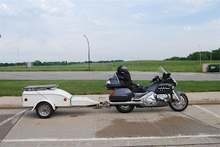
All the mechanicals worked great - solar setup, bike and trailer.
Seeing friends and distant family.
Getting home to family.
Lowlights:
Cold ride up the coast of California and Oregon into Coos Bay.
Missing some sights just due to lack of time.
There is so much to see on this continent. Beauty is everywhere! Just get out and go - you will find it.
Monday, July 28, 2008
Day 19


Stay away from the JC Whitney Outlet Center in LaSalle, IL!!
Sunday, July 27, 2008
Day 18
I started packing the bike after a noisy (remember the kids from the night before?) breakfast. Everything was wet, even under the bike cover. The ground didn't seem all that wet though. I got underway and quickly crossed into Minnesota. Lucky for me, I got there at the height of the "Annual Spreading of the Manure Festival" - WHEW!


I stopped at an anonymous rest stop somewhere in Minnesota and took inventory of the bike and trailer. Not bad, except for all the carnage.

I then came upon this sign. The story was interesting itself but what caught my attention was the 56 foot tall Jolly Green Giant. SWEET! I set off for the next exit and Blue Earth.


I couldn't find the spot where it was at first (that's because it was right in front of me). A quick tour of Blue Earth showed a really nice, pleasant town. I immediately wondered what was wrong with it. Anyway, I finally found the Jolly Green Giant. I took a couple of pictures around the park (doesn't it look like Bett Midler modeled for the wooden cut out?) but the picnic tables were so far away that you can see how far I could make it up the back stairs of the giant. Oh well.


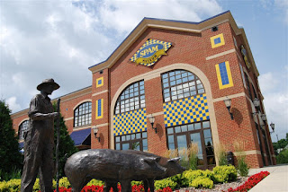
I got back on the highway and within a few minutes a billboard flashes by announcing the SPAM Museum - SWEET (again)! I missed the exit but went to the next and came back around to exit 176B, Austin, MN. Unfortunately, it was only 11:15 and the museum didn't open until noon. I took a couple pictures, including the one of the SPAM-related fare at the restaurant across the street, and left as tourists started pouring into the parking lot of the museum.
The AAA maps indicated I should get off at exit 193 and take the scenic route, US-16 (Historic Bluff County Scenic Byway), for the rest of the time in MN to La Crosse, WI. I stumbled across a couple things along the way. I saw a sign that said "Frank Lloyd Wright Visitor Center" - SWEET! But couldn't find it.


A little while later I stopped to reference my map and came across a consignment business that was storing the components for a wind farm. I had seen a few in Minnesota but someone was going in big time. You can see a tower in place behind the bike in a field opposite the consignment facility. Nothing like finding these little diversions along the way...
Speaking of diversions - what's with all the parades!? I got into Houston, MN and they had a parade going on that required a detour. This was the third parade I had encountered.

Once in La Crosse, WI, I was on the Great River Road - a route we had next planned on exploring after doing Route 66.


But all this was taking too long. I finally made it to Donna & Eric's about 7:30. I played with Otis and we went out for a quick bite to eat at an Irish pub in the Highland Park area. No fancy beers, just a Stella. Donna and Eric treated me to dinner - thanks guys!!
We chatted for a bit, talked about the JC Whitney Outlet Center and then retired for the evening.
Saturday, July 26, 2008
Day 17


After a very pleasant night at the Devil's Tower campground (dinner was some wheat thins and a 22oz BL Lime), I made an early start - quietly packing up while the other campers slept.


One last hurrah and I was off. How about this location for a "rallying" point?
I took US-14 down through Sundance, had a quick coffee with Robert Redford and carried on via interstate to the Deadwood exit. I was determined that I would bypass Sturgis this time as it was getting busy with Bike Week. Anyway, I had decided to see Deadwood, Mt. Rushmore and Crazy Horse and would have to backtrack somewhere along the line to go into Sturgis.


This was at a quieter section of town, toward the west end. I went quickly through Deadwood as there was a parade at 9:45 AM and I didn't want to be stuck there for hours. The alcove was for a lawyer's office and the tall building was the courthouse. Very quaint little town, I'll have to spend more time there in the future.

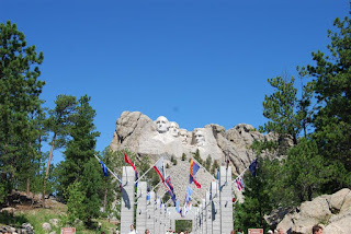
From Deadwood, I took US-385 and US-16 down toward Mt. Rushmore. Just before turning into the parking area, there is a turnout where you can see the monument. I pulled over and took the requisite photo. The Wing and trailer would not hold with just the front brakes alone! There was enough gravel there and the weight far enough back that it was dragging the Wing backward. It was pretty dicey getting back out into traffic.


I didn't have the $10 cash to get in, so the nice lady let me go in and use the ATM. After my visit, I dutifully went back through then entrance and paid my $10. This is the most sophisticated setup of any National Monument I've seen. Covered parking, cafeteria, gift shop - all looks pretty new. While I was in the cafeteria, I had a pie and coffee. The coffee wasn't bad but the rhubarb pie was the worst pie I ever had and together cost me $4.73. Meanwhile, they had a nice breakfast special (sausage, eggs, etc) for $4.95. Oh well. There are goats feeding as you walk toward the monument. I saw that one of the builders could have been related.


I got lots of shots of the monument of course. But I quickly got bored, so I took out my pocket knife and got busy!
I left the monument around noon and made a wrong turn and ended back in Keystone. That was OK as I stopped in a Dq and had something chilly to eat. While there, I chatted with a nice couple from Nanaimo, BC who were just cruising in the area on their new Yamaha Venture. I gassed up and headed out to Crazy Horse.

This is around back of Mt. Rushmore.
The ride down US-385/US-16 to Crazy Horse wasn't very long. Turning left onto Avenue of the Chiefs, I could get a glimpse of the sculpture ahead. Tom Miller had recommended coming here and commented about the scale. It was readily apparent that this thing was huge. As shown later during one of the videos, the heads of Mt. Rushmore would all easily fit behind Crazy Horse's head.


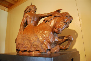
Some of the sculptures by the artist, Korczak Ziolkowski, outside the Visitor Center. Crazy Horse takes no government money. While they admit, they could do it faster, they would prefer to be funded by the public in order to avoid influence in the project by the government.


Again, I spotted some "marks" - three girls each taking pictures of the other two. I offered to take a picture of all three and they in turn took mine.


Some close-up shots. The horse's head is outlined. The completed head of Crazy Horse measures nine stories tall, the horse's head, will measure 22 stories tall and overall the carving will be 563 feet high and 641 feet long. Completion would make it the largest sculpture on earth.


Pictures of smaller scale mock-ups and other sculptures by the artist.
I hit the road after about an hour at Crazy Horse. The entire Black Hills area is great riding, no wonder it is such a huge destination for bikers and non=bikers alike. I plan to return here again.
I got on SD-79 north toward Rapid City and then cut over onto SD-44 toward the Badlands. While wind had been a factor for a lot of the trip, along SD-44 was particularly bad but only for a short stretch. If my helmet wasn't strapped on, it would have blown off.


I entered the Badlands easy enough but when I wanted to cut north to get to I-90, I ended up on a dirt road. I didn't want to drive the 30 miles or so to the next spot, so I turned around. I eventually ended up on the correct road and when I got to the park entrance, I decided to go the short route since I had spent so much time in the Black Hills area. My "toll" through the Badlands was $10 but worth it - other than the roads which are probably the worst of any National Park. The Badlands are coldly beautiful, very much like a moonscape. Some parts reminded me of old sci-fi paintings of moonscapes from the 50s. It was a mild 99F in the park.
At a rest stop in Chamberlain, SD. The bridge is the Lewis & Clark Bridge looking west at Oacoma and spanning Lake Francis Case - which looked like a really long river to me. The teepee artifact was a common sight at rest stops in South Dakota.
I made Sioux Falls, SD around 10 PM. The first hotel had no rooms, so a biker lady who also needed a room, high-tailed it to the next hotel which did have rooms. Unfortunately, there was yet another sporting tournament going on and lots of running and screaming kids. A bar across the street was having some kind of party - loud bikes, loud cars, loud people. Next door but separated by 18-wheeler parking was Grandma Max's which was recommended by the hotel clerk. I had steak and eggs and asked for a local beer as usual. I guess Leinenkugel was as close to local as it gets in Sioux Falls, SD. I had a couple Honey Wheats, then a nap. I should make it to Chicago by tomorrow!


